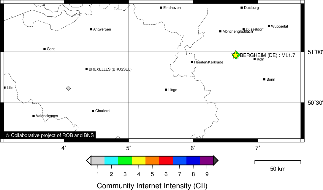
BERGHEIM (DE) - 2017-12-19 02:24:40
- Magnitude 1.7
Last update : 2018-01-03 15:03:35 Belgian time
Main parameters
| Date and time |
2017-12-19 02:24:40 UTC
2017-12-19 03:24:40 Belgian time |
| Type | Known induced event |
| Magnitude | ML 1.7 |
| Region | BERGHEIM (DE) |
| Epicentral coordinates | 50.968° N, 6.655° E Uncertainty ± 0.9 km |
| Depth of hypocenter | 0.1 km |
Data source : BNS (Cologne University)
Location map
Quake measurements
Measurements by the Belgian seismic network
| Station | Epicentral distance (km) |
P-Wave arrival (hh:mm:ss.ss) | S-Wave arrival (hh:mm:ss.ss) | Maximal ground displacement (nm) |
|
|---|---|---|---|---|---|
| Code | Place | ||||
| MEMS | MEMBACH | 60 | 02:24:50.99 | - | - |
| MRG | MONT RIGI | 65 | 02:24:51.86 | - | - |
| CLA | CLAVIER | 113 | 02:24:59.82 | 02:25:15.54 | - |
| GES | GESVES | 128 | 02:25:02.71 | 02:25:19.21 | - |
| WLF | WALFERDANGE | 150 | 02:25:05.36 | - | - |
| DOU | DOURBES | 175 | 02:25:09.31 | 02:25:30.96 | - |
Macroseismic
Data
| Total number of responses | 10 |
|---|---|
| Intensity I | 1 |
| Intensity II | 1 |
| Intensity III | 5 |
| Intensity IV | 3 |
Attention! The intensities derived from the macroseismic enquiry are raw unverified data.
Map
Data policy
Please read on this notice to learn more about our data policy.